Oyashio Fornt
- Here, this page provides the time series of the location of the Oyashio front in the off Tohoku field, Japan estimated from the database of the sea water temperature map based on the observation data.
-
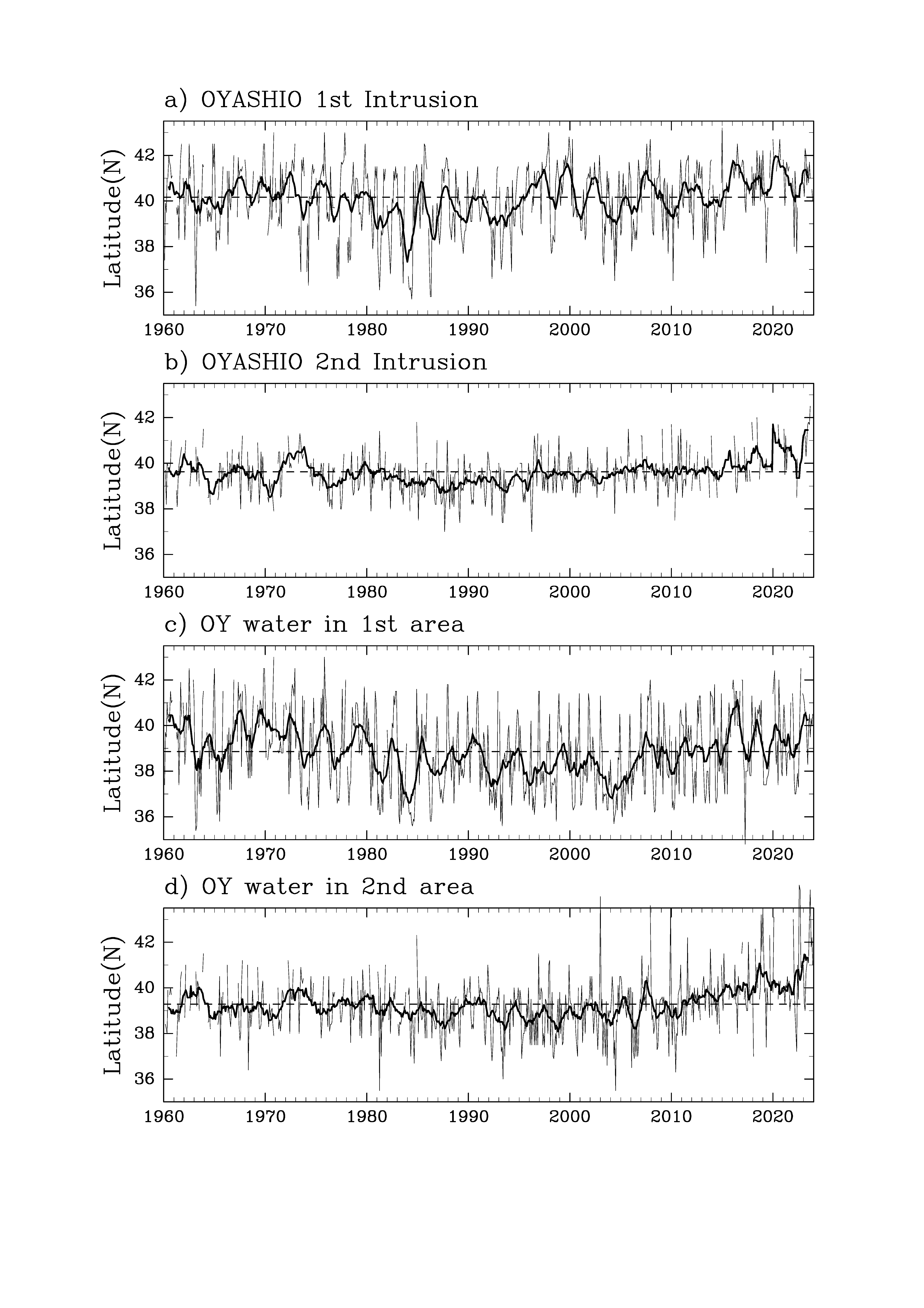
Interannual variation of Oyashio front
-
a) Southernmost latitudes of the first Oyashio Intrusion
-
b) Southernmost latitudes of the second Oyashio Intrusion
-
c) Southernmost latitudes of the Oyashio Water (100m depth and 5°C) in the coastal reagion region of the Tohoku, Japan
-
d) Southernmost latitudes of the Oyashio Water (100m depth and 5°C) in the offshore reagion of the Tohoku, Japan
-
Thin solid line: Southernmost latitude in each month
-
Thick solid line: 13-month moving average
-
Dashed line: average latitude from 1960 to 2020
-
Top Page
Off Tohoku Temperature Field
(c) Copyright Japan Fisheries Research and Education Agency All rights reserved.
Contact Us: bathy@ml.affrc.go.jp